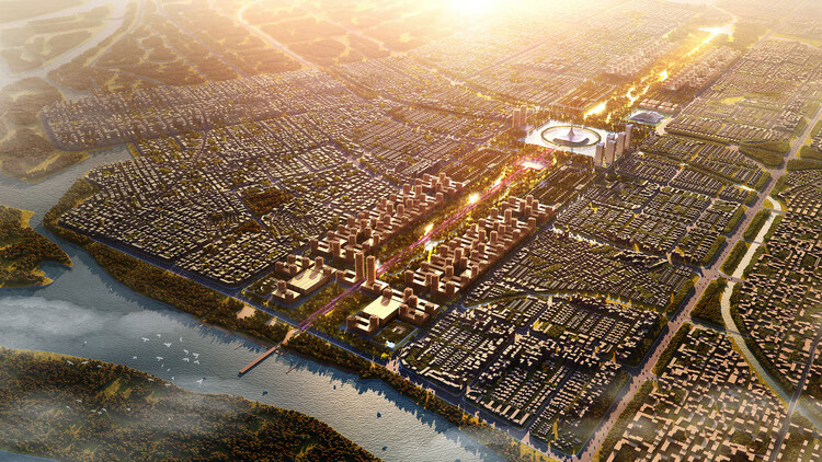
A new capital is usually introduced through its principal buildings: the assembly, the secretariat and the ceremonial spaces that give a seat of government its public image. In Amaravati, India’s Andhra Pradesh, that image of a new capital sits within an older landscape of cultivated fields, villages and established routes. Before the capital project, the region was already occupied by agricultural villages, local roads and settlements connected to the Krishna River and its water systems. The capital project is reorganizing this agrarian territory into a planned administrative city, bringing existing settlements and land ownership into the process of urban development. Its architectural identity will depend on how the new buildings, infrastructure, and public spaces relate to the settlements and landscapes already there.Amaravati lies along the Krishna River, within a region of agricultural land and established settlements. After Andhra Pradesh was divided in 2014 to create Telangana, Andhra Pradesh began planning Amaravati as its new capital and administrative centre, using a master plan to guide development across the capital region. The Detailed Master Plan, notified in 2016, and the Integrated Infrastructure Master Plan, published in 2017, set out the proposed land use, transport network and urban infrastructure. The plan organised the proposed capital around neighborhoods, transport corridors, institutional districts and open spaces, distributing its functions across a planned urban area.Land pooling became a central mechanism in assembling this territory. Under the scheme, participating landowners contributed agricultural land in exchange for developed plots, making existing land ownership part of the process through which the new urban layout was assembled. The master plan was therefore shaped by an existing pattern of agricultural ownership, livelihoods and village settlement, all of which influenced how land could be assembled for the capital. In “Recasting Land: Agrarian Urbanism in Amaravati”, researcher Carol Upadhya examines how the transition was shaped by the region’s agrarian structures and inequalities. The land-pooling process consequently influenced the location and shape of the new roads, neighborhoods and development parcels.Water management is another major consideration in planning the capital. The planning documents address the relationship between drainage, existing water bodies and the proposed network of parks and green corridors. Amaravati’s planning documents address water management through a proposed network of water bodies, canals, parks and green corridors. In the Climate Change Action Plan for the Capital City of Amaravati, the Andhra Pradesh Capital Region Development Authority (APCRDA) identifies approximately 3,165 hectares of primary green spaces along existing canals and water bodies, alongside 505 hectares of secondary green spaces connecting parks and neighborhoods. These figures describe the planned landscape strategy rather than the area already completed.
The proposed network combines drainage infrastructure with recreational and ecological functions. The water bodies and drainage systems are intended to manage stormwater. Connected green spaces are planned as recreational routes, shaded areas and links between habitats. Its performance will depend on the continuity of these spaces and their connections to surrounding neighborhoods. A park’s contribution to the wider network will depend on how it connects to streets, waterways and nearby neighborhoods. The proposed green-blue network places water bodies, drainage corridors and public open spaces within the same planning framework, although its performance will depend on how these elements are connected and delivered.
The relationship between the planned city and its existing villages becomes visible at the settlement edge. The capital’s development area includes villages with established streets, buildings and local infrastructure that predate the master plan. The way these villages are incorporated will depend on how new roads, utilities and development parcels meet their existing streets and public spaces. New roads and utilities can connect a village to the wider city, while the arrangement of its existing streets, local markets and public spaces will influence how that transition is experienced.APCRDA’s Urban Design and Architectural Guidelines for Amaravati Capital City explicitly identify village integration, local heritage and cultural identity as considerations in the city’s development. They also set out objectives for walkability, mixed-use neighborhoods and connections to the Krishna River. The guidelines therefore treat existing villages as part of the planned city’s future structure, with their local identity and connections to the wider urban network requiring consideration.